

More than half of the world’s population lives in urban areas. Many of our cities are growing in density, and there are increasing government and private efforts to make urban spaces more social and lessen dependence on the car. This is happening in some of the United States’ densest cities, like New York City, where public projects along Broadway are turning traditional sidewalks and streets into pedestrian parks and gathering spaces. A more pedestrian-focused city poses unique issues of navigation and wayfinding. Although hand-held devices provide instant access to maps and directions, pedestrians learn about place through exploration and discovery.
Kevin Lynch discusses how residents view the city in a study published in 1960 called
Many residents in Baltimore City today orient themselves using landmarks. A series of walking interviews—that is, interviews conducted while walking through the city—with these residents revealed how personal points of reference helped them navigate the city. I conducted these walking interviews through the city’s cultural center, Mount Vernon. A lively city center, Mount Vernon contains distinctive buildings, public spaces and popular restaurants, bars, and shops. Many of the interview participants were familiar with this area, which allowed them to give detailed descriptions of our walk.
Twelve participants with diverse backgrounds were interviewed. Some were more familiar with the area than others. Each person’s response to the environment was unique, and individual memories of particular places helped each individual orient and navigate in different ways.
One participant, Sandy, described many of her landmarks in vivid detail. Each landmark stood out to her in a unique way. Her memories of each place created a strong network of reference points, and with that she has built a rich mental map of the area in which we walked. She felt comfortable enough to explore new paths and had no trouble determining her position and direction in the city during our walk.
“This is where my husband gets his hair cut.” Sandy stopped to look at the barber shop. “I have only been here once, and the shop was so crowded that I had to wait outside while he was in line for a cut. It was, of course, freezing that day, and I took a bunch of photos of the iced-over drain pipes on the side of the building. I got to meet the proprietor of the clothing store adjacent to the barber, which was lovely, but I have not ever gone back. I remember the striped barber’s pole was iced over that day, and every time I go by, I think of that.”
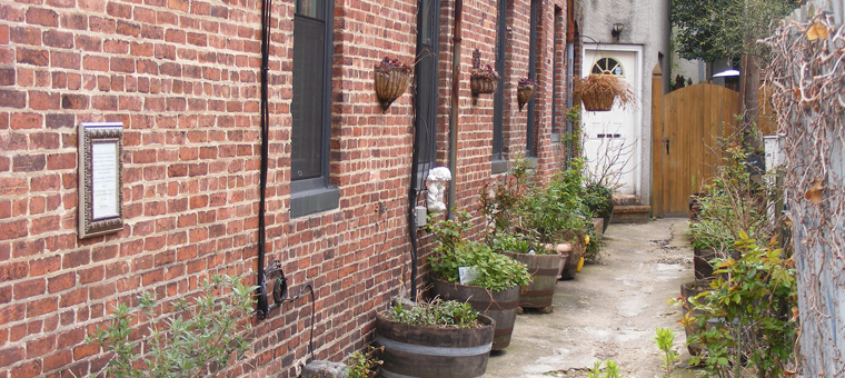
Sandy turned down a small side street. “I’ll take you down my secret path.” The route was clearly off the main street, and after we walked past some houses and crossed through a small courtyard, there was a garden space in between the packs of rowhomes. Peacock Garden, it was called. “I associate this place with a sense of community, people coming together to have a shared slice of peace. There are plants in barrel pots, and in the summer, there are overflowing flowers of every color in them. I particularly love the lavender. The smell is intoxicating.” Most of the garden was not much to look at in the winter, but Sandy could still smell the lavender she had remembered. The detour was an enjoyable experience for her no matter the season.
A rich mental map of a city, representing a diverse set of reference points and their associations, helped Sandy build familiarity and allowed her to feel more comfortable in her surroundings. A mental map, sometimes referred to as a cognitive map, is a personal representation of a geographical area. This cognitive depiction of space not only maintains relative location information for Sandy, but also individual meaning of a place’s function and purpose. While mental maps are often not accurate depictions of geographical space, the mental map represents an independent relationship with place. Sandy’s mental map contains personal points of reference collected through experience and memory of places in the city. Over time, her mental map may also change and grow with her experience. This is the strength of mental maps, allowing for new patterns of activity in the city.
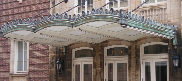
The mental map also helps determine current direction and location when you get lost. Another participant, Mark, used his mental map in a very different way. In Mark’s case, a particular landmark, the Schafer Building flag pole, provided assurance as to which direction he was heading. While he was largely unfamiliar with the area we walked through, his knowledge of landmarks reassured him. Mark’s familiarity with major street names and the city grid comes from his experience of driving through the city. He tended to look for street names first while walking in the city, and in some instances, street intersections and major road arteries acted as his landmarks.
“I’m just looking for Cathedral Street. I know we’ll run into it eventually.” Mark was puzzled, but he didn’t stop walking. I asked him how comfortable he felt and if he knew where we were heading. “I don’t,” he said.
Mark mentioned that he rarely traveled through this area, and when he did, he drove. He was walking a bit faster than my regular pace, perhaps because of the snowflakes falling, but I suspected he was anxious to get his bearings straight. He was quiet as we finally approached Cathedral Street. We took a right, and quickly he recognized and made note of a landmark in the distance. It was the top of the Schaffer building, with its flag pole poking high above the skyline. “Now I know what direction we are going,” he said. As we continued walking down the street, he described how he now knew South from North, and while he suspected Cathedral Street was a one-way street heading South, the landmark reassured him of his heading.
Certain landmarks become part of the larger public consciousness. The Transport for London attempted to remove the River Thames from the iconic Underground Tube map in 2009, and Londoners spoke up. Citizens, columnists from the Guardian and Daily Mail, even then-Mayor Boris Johnson cringed at the changes and immediately asked for the river’s return to the map. Why was the removal of the river taken so much to heart? Was it the river’s historical significance, so important to the city that no one could erase it, as though denouncing a loved family member? The River Thames is among London’s most familiar landmarks. It divides the city and, in doing so, creates a navigation device for all residents. Their mental maps depend on the location of the river. Even for riders of the Tube, while they may not be able to see the river from underground, the Thames is a necessary point of reference. The river serves as a physical connection between the simplified Tube map, and the mental map that residents had established.
Recognition of landmarks allows pedestrians to make connections between new landmarks while increasing the detail and depth of their own mental maps. Exploration and discovery increases connections between new landmarks and encourages new patterns of travel. Exploring and getting lost is an integral part of building a more complete mental image of the city.
Cameron confidently confessed during our walk that he never looks at a map or printed directions, even when going to a new place. He prefers to explore. An address and a sense of direction are all he needs. I wondered how he didn’t get lost. Cameron understood the city as a network of points and paths. He is always aware of where he is, and maintains a sense of his origin by referring to his developed mental map of the city. He walks everywhere and has built up an extensive network of landmarks that he uses to explore and extend his network further. He tells me of a project he did once where he tracked receipts pulled from trash cans throughout the city. “I remember every can I went to,” he recalls.
These walking interviews revealed how pedestrians use landmarks to navigate and find their place in the city. I found that landmarks were anything that provided a reference to location. Landmarks were given unique meaning by the pedestrian as to its function or purpose, and each person had a personal attachment to their memories of that place. A study by Lynne C. Manzo in 2005 called this “experience-in-place.” Memories of experiences, or the way a place makes a person feel, is what gives that place meaning. For my participants, the physical landmark acted as a reference to their experience, which in most cases was the true landmark.
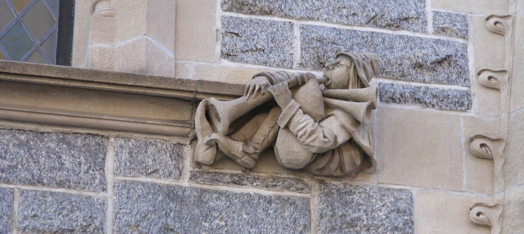
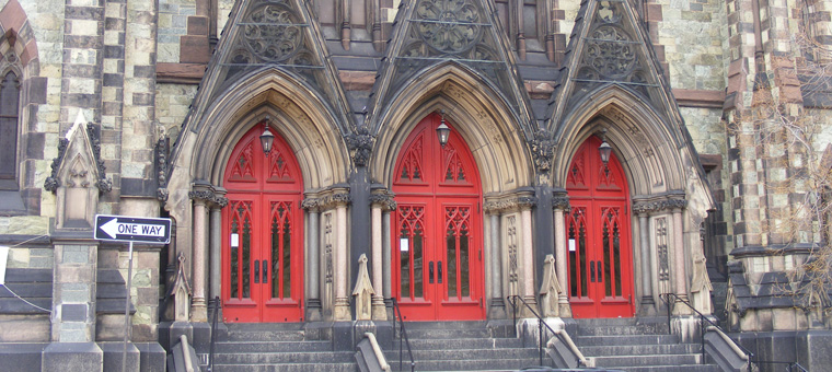
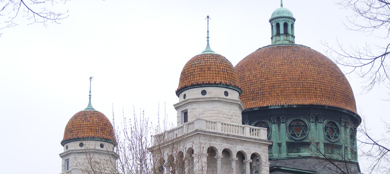
The participants’ experiences reflected in their descriptions of landmarks were primarily intimate and positive. They recognized more landmarks that were nearby, on the block or adjacent to the sidewalk. Moving through the city at a much slower pace than someone in a car allowed the participants to have a more intimate relationship with the environment. Small details became more important for orientation. For Alice, the small carving of a trumpeter resting on a window ledge on the side of the Emmanuel Episcopal Church was a more prominent landmark than the church’s high bell tower, or its detailed façade. For Steve, it was the church’s red doors, and to Callie, the texture of the stone. Each feature stood out to the pedestrians for different reasons.
These participants have built strong mental maps by connecting pieces to a broader network of landmarks and streets. While this helped them complete the task at hand, I still wonder how their task might have impacted the experience of wayfinding. For these interviews, the pedestrian’s task was more relaxed, as opposed to someone who is late for work. How does this change which landmarks are used for orientation? Does recognition of detail become less important? A future study might provide some insight into these lingering questions, but I could see from my initial study that recognition of landmarks allowed the pedestrians to choose the best route for their current task.
Wayfinding in an increasingly complex urban environment was made easier by the recognition of personal landmarks, increasing feelings of safety, security and confidence in all the participants. As cities become more dense, it is ever more important for residents to maintain familiarity and a personal relationship with their surroundings. Navigation software for hand-held devices that utilizes personal landmarks and allows for personalization of routes could benefit city dwellers. Pedestrians rely on their unique perspectives of the environment to navigate and enjoy the cities in which they live.